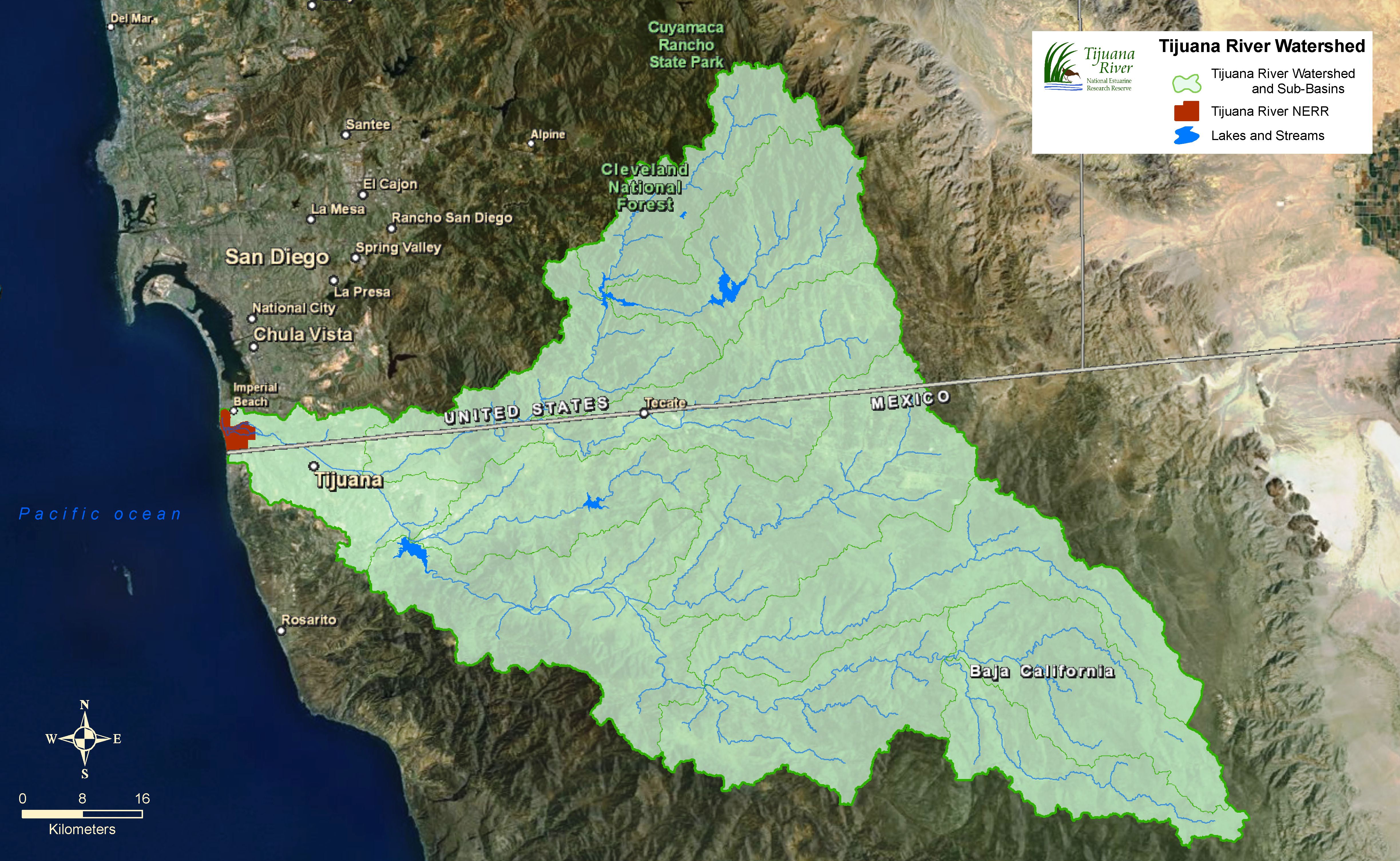
The image to the right is a map of Tijuana River Watershed. Watersheds are drainage basins. Rain, snow melt, and urban runoff flow down creeks, streams, and rivers to the sea. Coastal San Diego has 12 major watersheds connecting the interior mountains to the ocean.
The Tijuana River Watershed covers 1,750 square miles – three-fourths lies in Mexico and includes the cities of Tijuana and Tecate. We can all do our part to protect our watershed by not allowing harmful pollutants like motor oil, fertilizer, and plastic trash to enter storm drains and flow into the estuary and then the sea.
There are four reservoirs in the watershed (Barrett and Morena in the United States, and Rodríguez and El Carrizo in Mexico). Reservoirs store water for human use but disrupt sand delivery to the coast and displace native habitat. Sediment related to urban development fills in wetlands and reduces habitat for fish and birds. By keeping slopes vegetated around our homes, we can prevent sediment from entering coastal wetlands.
The Tijuana River Watershed (consisting of sub-watersheds) reaches from sea level to Sheephead Mountain (5,783 feet) in the Laguna Mountains. The lowlands of this arid watershed receive about 10 inches of rain per year, the mountains 25 inches.